|
Home Page
Shops &Services
Clubs, Charities, Religions
Holiday Accommodation
Weather Forecast & Links
Gala
Faces and Places
Bus Times
Historical
Some Local Websites
Books
Contact Us
New Discovery
|
Rhynie has lots of History!!
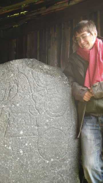
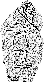
Pictish Carved Stones . . .
Rhynie has more of them per acre than anywhere else
(Aberlemno in Angus is a close second-best)
Click on the image to read more
There's a new thesis written about the Rhynie Chert, it's too technical to read, but here it is
Click here to read about fossils
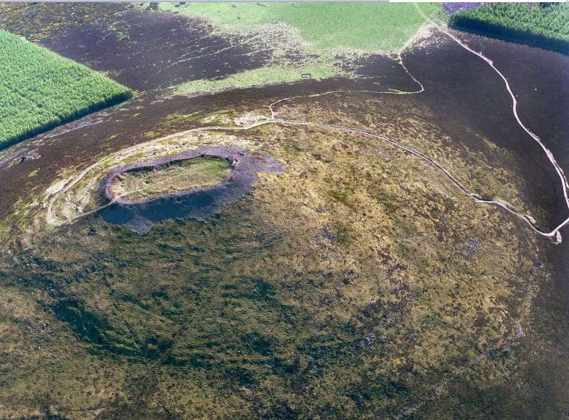
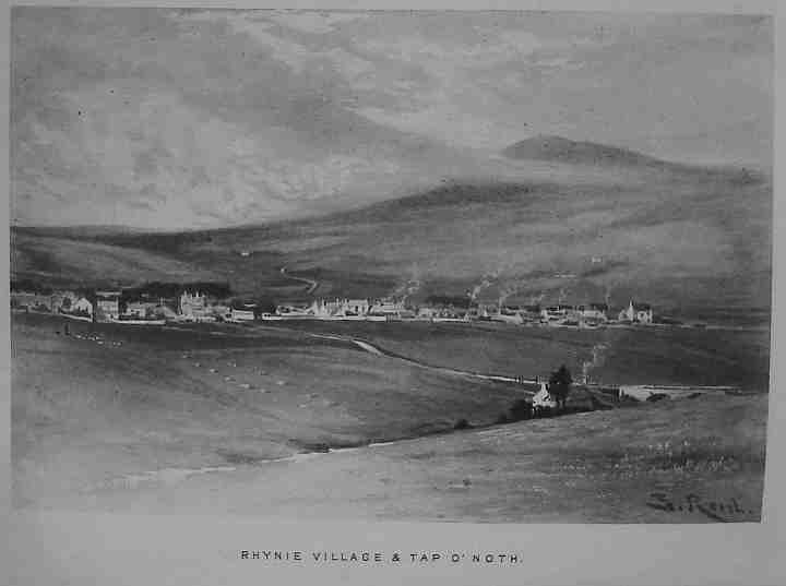
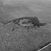
The hill with the flat top that you can see from Rhynie Square . . .
It's believed to be the remains of a fort 2,000 years old'
Click on the image to read more
 Click here for lots of information about the Tap o' Noth
(you have to scroll down to the fourth hillfort that's pictured, below "defended settlements")
Lots of interesting old things have been found
over the centuries.
Click on the image to read about 80 references
from the "Canmore" website, from the fascinating to the trivial

Pictish Finds
The last few summers, there have been archaeological digs to the south of Rhynie.
The most wonderful find so far, is this fine metal kilt-pin.
Click here..DIG PHOTOS.. to see photos from last year's dig
Click here for lots more information
Rhynie Mutual Instruction Society
There were a lot of 'educational' societies formed in Scottish towns in the 19th century.
Rhynie Mutual Instruction Society was one of the first, in the 1840s.
Click here
to read a report from the Aberdeen Journal (ancestor of the Press & Journal)
"Placenames of Strathbogie"by J.Macdonald. An interesting book, written in the 1800s. Some of the derivations are a bit fanciful...
Click here to read it (plain text version)
Click here
to read it (Adobe Acrobat PDF version)
GulburnSomebody wrote from Australia asking where Gulburn is/was......
their ancestors came from there.... it's mentioned in "Placenames of Strathbogie"
but it's not on the modern map .... here's the Huntly Estate map from about 1770 .... everything has changed but the course of the River Bogie
is the same so that gives a landmark to compare the two maps

When the old map was made, it wasn't standard to put North at the top of the map.
This one was drawn for the Gordons Estate, so it is drawn as if you were looking out from Huntly Castle towards Rhynie

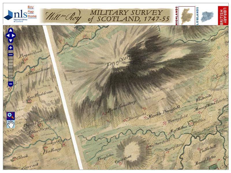
Click the image to see a map of Rhynie in 1750
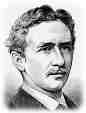
Mackay of Uganda (and of Rhynie)
Click on the picture to read about his life . . .
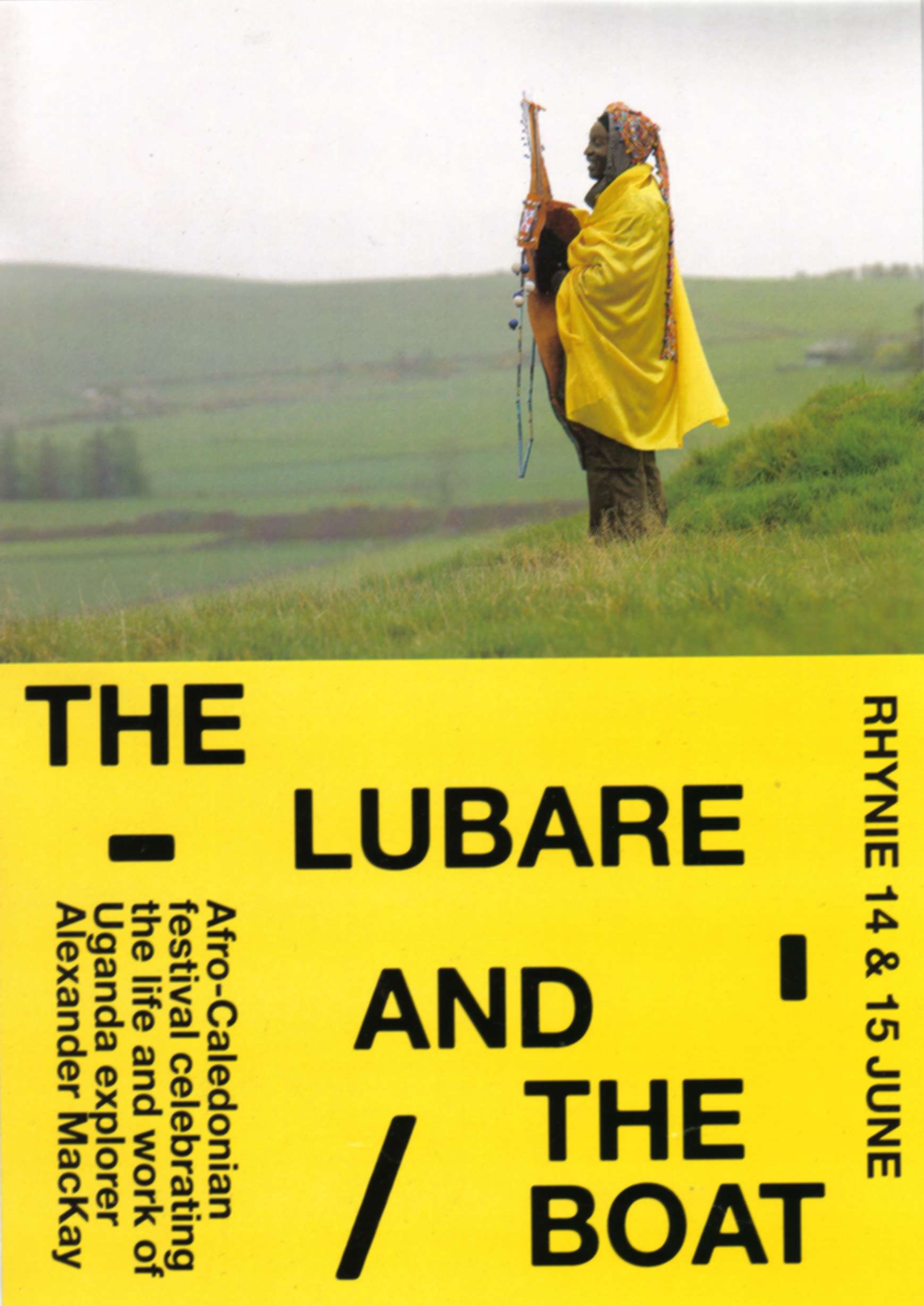
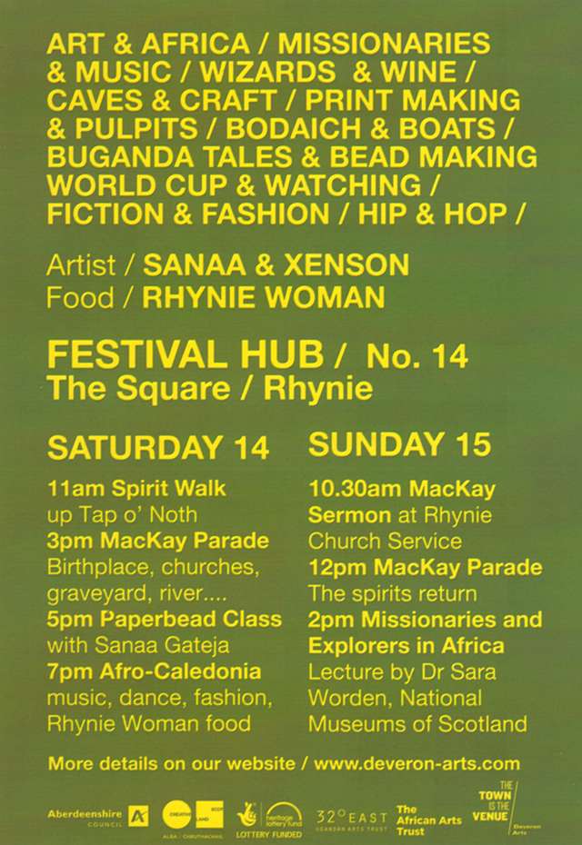
In JUNE 2014, Deveron Arts held a Mackay weekend,
THE LUBARE AND THE BOAT
EVERYTHING AFRICAN...with reference to Mackay of Uganda

Drawing of Rhynie about 1850
Click on the picture to see it in more detail . . .
Lays of Strathbogie
This is a collection of poems, mostly in a 'romantic' style
It mentions lots of places around Rhynie
Lays of Strathbogie.........click here to read this book of poems("Word" version)
Lays of Strathbogie.............click here for "Acrobat" PDF version
Click here for some obscure references to Strathbogie in Medieval times
Click here for a huge amount of information about archaeology in scotland
(It's arranged alphabetically; Scotland is two-thirds of the way down the page)
Click here for info about traces of 17th century cultivation in the forestry west of Rhynie
Click here for information about the unique rock 'Rhynie Chert', with photos taken through a microscope

|